Photos from Bryce
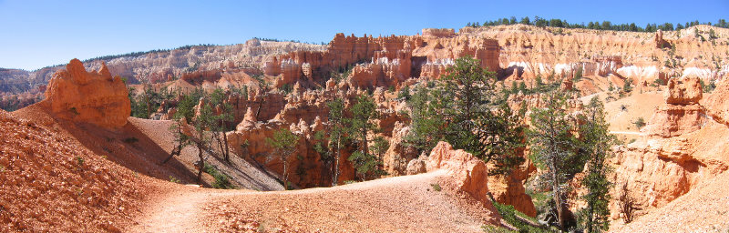
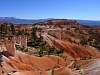
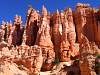
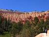
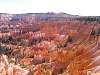
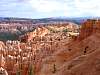
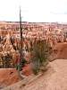
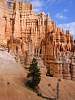
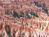
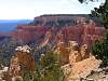
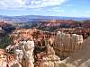
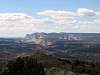
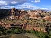
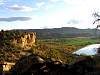
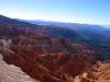
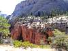
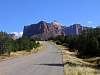
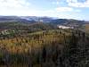
Views from Sunrise Point
97.54 KB
2005:09:26 12:10:32
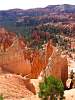
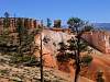
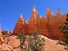
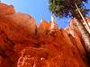
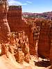
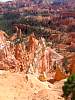
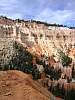
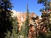
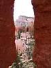
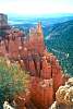
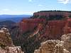
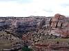
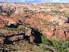
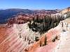
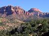
Views along Queens Garden trail.
104.41 KB
2005:09:26 12:20:33
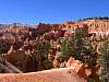
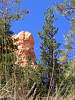
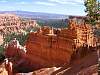
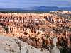
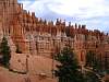
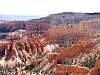
Views along Queens Garden trail.
91.46 KB
2005:09:26 12:24:26
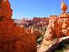
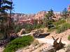
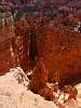
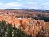
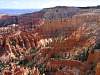
Views along Queens Garden trail.
77.68 KB
2005:09:26 12:41:25
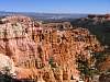
Views along Queens Garden trail.
93.65 KB
2005:09:26 12:45:12
Views along Queens Garden trail.
105.02 KB
2005:09:26 12:59:13
Views along Queens Garden trail.
87.05 KB
2005:09:26 13:06:24
Views along Queens Garden trail.
110.83 KB
2005:09:26 13:13:53
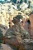
See queen Victoria to the left?
79.71 KB
2005:09:26 13:23:26
View along Queens Garden trail.
112.83 KB
2005:09:26 13:43:42
View along Queens Garden trail.
111.02 KB
2005:09:26 13:52:04
View along Queens Garden trail.
84.48 KB
2005:09:26 14:21:44
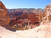
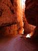
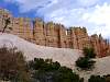
Wall Steet section of Navajo trail
89.23 KB
2005:09:26 14:41:22
Wall Steet section of Navajo trail
65.79 KB
2005:09:26 14:42:54
Wall Steet section of Navajo trail
91.93 KB
2005:09:26 15:01:30
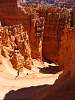
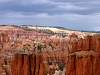
View from Sunset Point
95.24 KB
2005:09:26 15:05:47
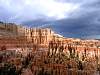
View from Sunset Point
102.75 KB
2005:09:26 15:08:16
View from Sunset Point
96.67 KB
2005:09:26 15:15:12

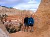
Colleen on the Rim trail from Sunset to Sunrise point.
88.13 KB
2005:09:26 15:57:56
View from Sunset point
117.87 KB
2005:09:26 16:06:17
View of Sunset point
88.80 KB
2005:09:26 16:09:50
View from Sunset point
124.89 KB
2005:09:26 16:10:56
Looking towards Sunset Point
111.44 KB
2005:09:27 10:56:55
Looking towards Sunset Point
99.49 KB
2005:09:27 11:03:42
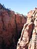
Descending from Bryce Point.
91.20 KB
2005:09:27 11:04:48
Looking towards the Wall of Windows.
85.86 KB
2005:09:27 11:24:12
Grottos under the rim.
96.23 KB
2005:09:27 11:25:21
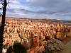
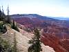
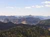
Looking towards Sunrise Point
98.00 KB
2005:09:27 11:26:33
Looking towards Sunrise Point
89.58 KB
2005:09:27 11:28:36
Looking towards the Wall of Windows.
127.62 KB
2005:09:27 11:40:01
Looking towards the Wall of Windows.
83.04 KB
2005:09:27 11:53:17
Looking towards the Wall of Windows.
80.68 KB
2005:09:27 11:56:27
Looking towards the Wall of Windows.
94.14 KB
2005:09:27 11:58:02
Looking towards Bryce Point
68.78 KB
2005:09:27 12:23:29
Looking towards Sunrise Point
72.43 KB
2005:09:27 14:02:32
Looking towards the Wall of Windows.
82.98 KB
2005:09:27 14:05:14
Hodoo's along the Peekaboo trail.
115.10 KB
2005:09:27 15:13:27
What a coincidence! A rainbow while at Rainbow Point!
58.56 KB
2005:09:27 16:10:33
Views from Piria View.
90.92 KB
Views from Piria View.
113.71 KB
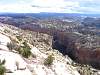
View of the Rim from Paria Point.
103.65 KB
2005:09:29 13:30:47
View of the Rim from Paria Point.
74.66 KB
2005:09:29 13:48:06
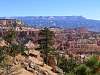
Bryce Point from Inspiration Point.
97.17 KB
2005:09:29 14:09:33
Bryce Point from Inspiration Point.
94.09 KB
2005:09:29 14:10:42
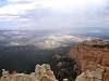
View from Inspiration Point.
98.42 KB
2005:09:29 14:25:13

Sunset Point from Inspiration Point.
105.24 KB
2005:09:29 14:27:08
Photos from Day trip to Boulder, UT and travel to Zion
Kodachrome Basin - Starting up Eagles view trail.
95.05 KB
2005:09:28 11:53:46
Kodachrome Basin area viewed from Eagles view trail.
68.51 KB
2005:09:28 12:25:48
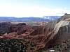
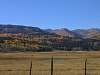
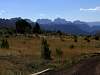
Powells Point
68.23 KB
2005:09:28 12:36:24
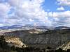
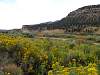
Looking south to Lower Hackberry Canyon
51.70 KB
2005:09:28 12:45:53
Escalante River west of Escalante
92.92 KB
2005:09:28 14:53:29
Escalante river along scenic Hwy 12 east of Escalante.
83.11 KB
2005:09:28 16:43:51
View of Calf Creek along scenic Hwy 12.
105.10 KB
2005:09:28 17:06:30
Escalante River along scenic Hwy 12 east of Escalante.
105.13 KB
2005:09:28 18:09:42
Escalante River along scenic Hwy 12 east of Escalante.
124.02 KB
2005:09:28 18:10:20
Walk at Petrified forest near Escalante.
118.39 KB
2005:09:28 19:13:58
Colorful petrified trees
123.60 KB
2005:09:28 19:27:04
Walk at Petrified forest near Escalante.
75.33 KB
2005:09:28 19:37:52
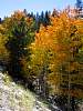
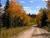
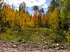
Fall color along Scenic Hwy 143
134.73 KB
2005:09:29 16:08:32
Fall color along Scenic Hwy 143
54.95 KB
2005:09:29 16:15:20
Fall color along Scenic Hwy 143
106.18 KB
2005:09:29 16:20:48
Cedar Breaks NM
61.82 KB
2005:09:29 16:54:46
Cedar Breaks NM
96.23 KB
2005:09:29 16:54:56
Cedar Breaks NM
85.17 KB
2005:09:29 16:56:18
Photos from Zion National Park
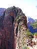
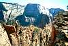
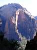
Angels Landing.
96.76 KB
2005:09:30 12:30:43
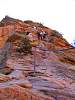
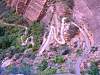
Chains help on the steep sections of Angels Landing.
81.93 KB
2005:09:30 12:46:32
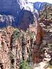
Angels Landing
89.68 KB
Angels Landing and Walter's Wiggles
119.54 KB

Alan at the top of Angels Landing.
100.07 KB
2005:09:30 13:00:30
Angels Landing and Walter's Wiggles.
126.81 KB
2005:09:30 15:37:51
Lunch location for Walter's Wiggles photo.
124.07 KB
2005:09:30 16:13:54
Lunch location for Walter's Wiggles photo.
85.05 KB
2005:09:30 16:36:53
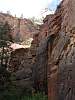
Red Arch Mountain.
69.19 KB
2005:09:30 17:19:11
Trail up to Refrigerator canyon.
110.33 KB
2005:09:30 17:25:45
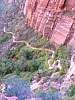
Trail up to Refrigerator canyon.
116.09 KB
2005:09:30 17:25:57
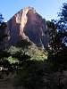
Red Arch Mountain.
88.71 KB
2005:09:30 17:56:18
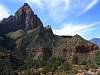
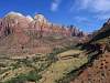
The Towers of the Virgin.
84.93 KB
2005:10:01 12:03:38
The Watchman.
79.01 KB
2005:10:01 12:10:25
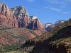
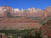
View of Zion Canyon.
79.19 KB
2005:10:01 12:18:59
View of Zion Canyon.
94.05 KB
2005:10:01 12:20:36
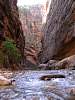
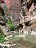
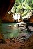
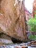
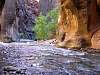
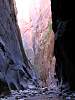
The Narrows
103.42 KB
2005:10:02 12:44:45
The Narrows
108.69 KB
2005:10:02 12:58:49
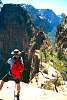
Colleen and Alan enjoying a snack.
97.67 KB
2005:10:02 13:17:18
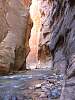
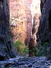
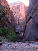
The Narrows
94.92 KB
2005:10:02 13:21:14
The Narrows
93.98 KB
2005:10:02 13:41:23
The Narrows
118.75 KB
2005:10:02 13:50:56
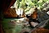
Alan at a deeper crossing of the river.
100.14 KB
The Narrows.
100.06 KB
The Narrows
116.07 KB
2005:10:02 14:00:26
The Narrows
108.87 KB
2005:10:02 14:05:19
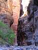
The Narrows
104.22 KB
2005:10:02 14:06:04
The Narrows
93.25 KB
2005:10:02 14:27:00
The Narrows
83.24 KB
2005:10:02 14:27:13
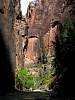
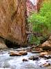
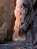
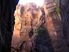
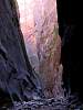
The Wall Street part of the Narrows.
101.12 KB
2005:10:02 14:52:46
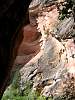
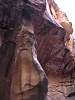
Canyon walls of the Narrows.
73.33 KB
2005:10:02 15:02:57
Canyon walls of the Narrows.
66.37 KB
2005:10:02 15:31:42
Canyon walls of the Narrows.
110.41 KB
2005:10:02 15:32:04
The Wall Street part of the Narrows.
100.02 KB
2005:10:02 15:39:12
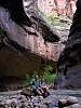
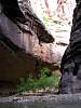
Along the Orderville canyon
78.91 KB
2005:10:02 15:55:46
Along the Orderville canyon
71.57 KB
2005:10:02 15:56:19
Evening colors on the return trip.
93.10 KB
2005:10:02 17:06:03
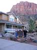
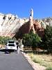
Tom and Aunt Janice, hosts of Harvest House B&B
89.61 KB
2005:10:03 10:29:28
Along the Kolob Resevoir Rd.
61.45 KB
2005:10:03 11:50:03
Along the Kolob Resevoir Rd.
94.63 KB
2005:10:03 11:53:10
Zion's West Temple in the back ground.
53.56 KB
2005:10:03 12:23:00
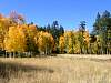
Fall color along Kolob Resevoir Rd.
113.59 KB
2005:10:03 12:44:10
View from Lava Point.
76.08 KB
2005:10:03 12:57:06
View from Lava Point.
44.50 KB
2005:10:03 12:58:08
Fall color along Kolob Resevoir Rd.
148.41 KB
2005:10:03 13:13:06